|
| *****SWAAG_ID***** | 666 |
| Date Entered | 30/12/2012 |
| Updated on | 30/12/2012 |
| Recorded by | Ric Carter |
| Category | Burial Mounds and Cairns |
| Record Type | Archaeology |
| Site Access | Public Access Land |
| Record Date | 01/12/2012 |
| Location | Stang Top (West of) |
| Civil Parish | Hope |
| Brit. National Grid | NZ 01844 06936 |
| Altitude | 528m |
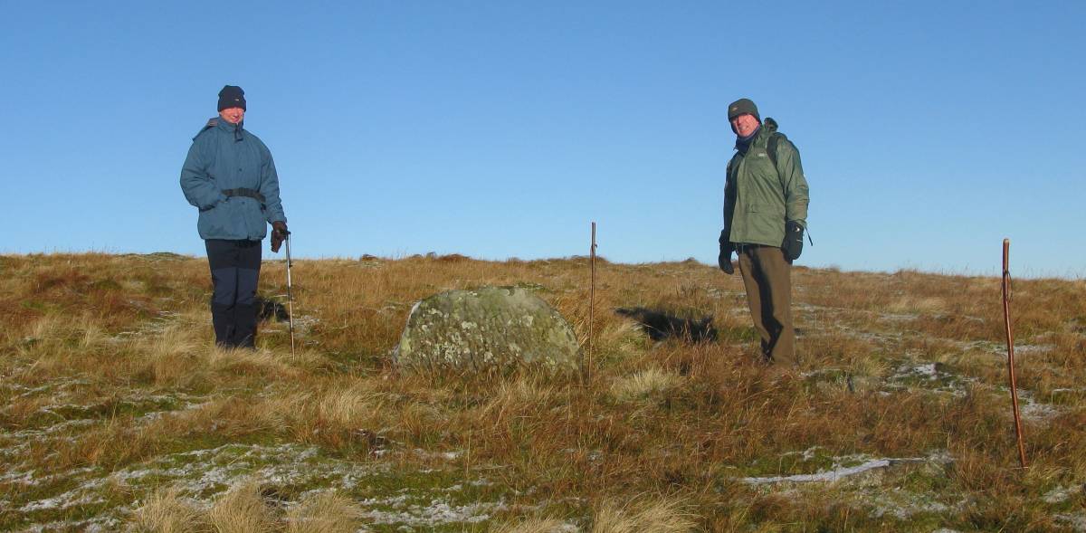
| Record Name | Marker Stone West of Stang Top |
| Record Description | Unenscribed Marker Stone(?)with kerbing West of Stang Top and visible from the roadside parking area at the County boundary. Possible Grave Marker. May be associated with the Scheduled Bronze Age Cairn at Arndale Hill summit ( NZ 02400 06720 ) approx 1km. to the East.
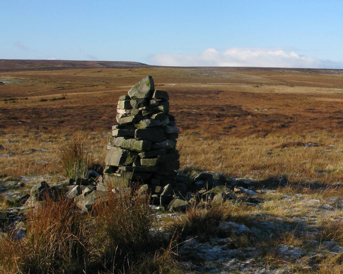
The Marker Stone is not scheduled although the Andale Hill Cairn is (List Entry No.1017426) where it is described as approx 8m in diameter x 0.3m high; a tall modern stone cairn having been built in the centre of the prehistoric cairn, re-using much of the stone from the original cairn. It is also said to form an important part of the prehistoric landscape of Hope Moor and Barningham Moor where numerous other sites survive (see T.C.Laurie other database entries)including Cairns, Rock Art, Settlements and Agricultural Field Systems |
| Image 1 ID | 3882 Click image to enlarge |
| Image 1 Description | Marker Stone West of Stang Top |  |
| Image 2 ID | 3883 Click image to enlarge |
| Image 2 Description | Arndale Hill summit Cairn |  |